Glimmer of Hope, or Maybe Just a Mirage
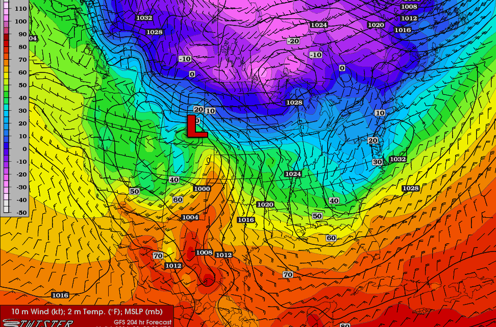
Looking at the long range GFS (I know, I know,) there is something that caught my eye. (Image missing.) This is the surface temperatures, winds, and MSLP at 276 hours out. Yes, that is super ridiculously far out. Yes, it’ll most likely change. But with the lows position in northern Wisconsin, and northern Illinois sitting…
Re: Next Severe Weather Event
Yeah, the latest runs of the GFS have already completely changed the previously described scenario. The low that was originally progged to move through the area on March 2 isn’t even there any more. But that’s what I get for being hopeful about forecast models at over 200 hours out. The GFS does show a…
Next Severe Weather Event?
With yesterday’s severe weather event in the books, and northern Illinois slipping back into winter, I’ve been looking at the GFS; eagerly looking for the next event as well as some more spring like temperatures. There is a possibility on March 2: A surface low will move through the Central Plains into the Mississippi River…