Multi-day severe weather event begins today
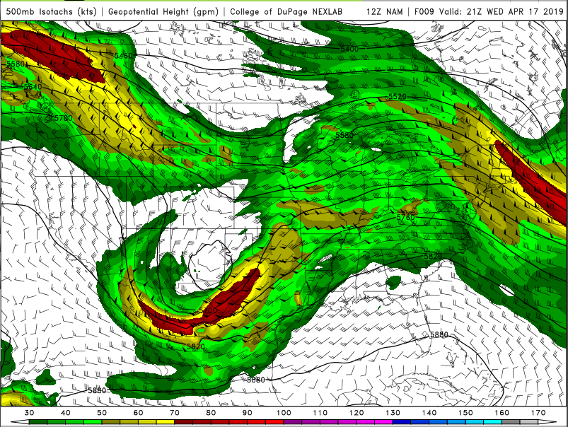
The next wave of severe weather has arrived. As depicted on the image below, there will be a combination of a shortwave trough and a somewhat cut off low moving through the Midwest this afternoon. The somewhat cut off low, with its forecasted 80+ knot winds, will be providing the most upper level support today. But the trough in the north will still provide enough vorticity advection for thunderstorms today in parts of Iowa and Illinois.
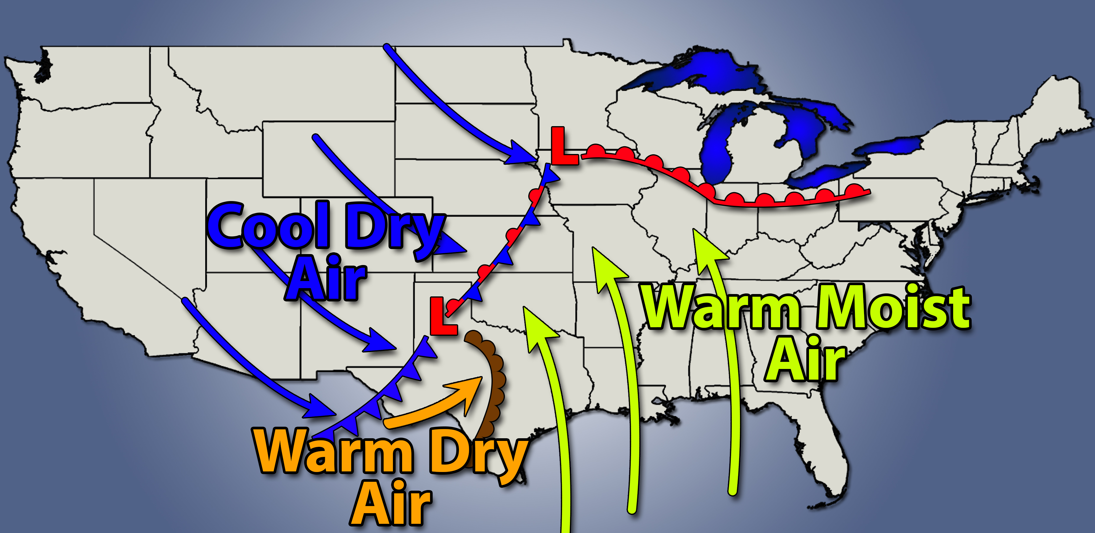
At the surface, the primary area of low pressure (which is currently in northeastern Nebraska,) will move to the northeast to the Minnesota – Iowa border. Meanwhile, a secondary area of low pressure will develop in the Texas panhandle; and will move east towards Oklahoma. A dry line will extend to the southeast out of this secondary low.
This set up will result in two main areas of severe weather potential; the first up north near the primary low in the Mississippi Valley, the second ahead of the dry line near I-35 and the Red River.
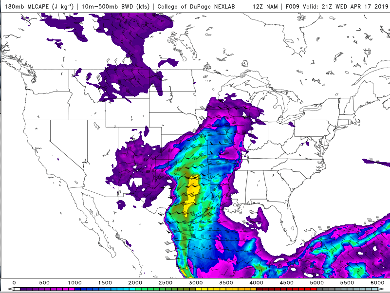
The southern target area is where the best chances for severe weather will be. There, surface temperatures should reach the 70s and 80s, while surface dewpoints reach the 60s and 70s. This warm, moist boundary layer will result in a good amount of instability; upwards of 3,500 j/kg of ML-CAPE in some areas. The northern target will have some instability as well, perhaps up to around 2,000 j/kg as well.
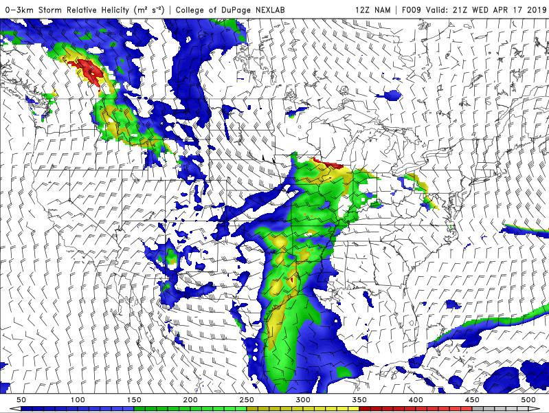
The final ingredient for severe weather is wind shear. In this case, the more northern target area is the more favorable area. The northern area will have added wind shear from the warm front and from the primary low itself. The southern target has some wind shear as well, although the flow gets more unidirectional as you move up in the atmosphere.
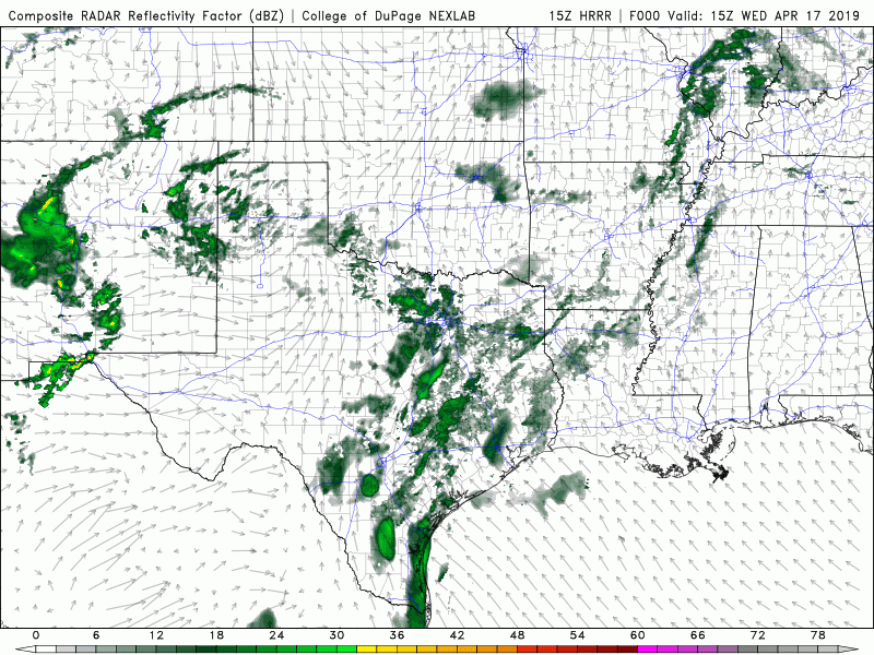
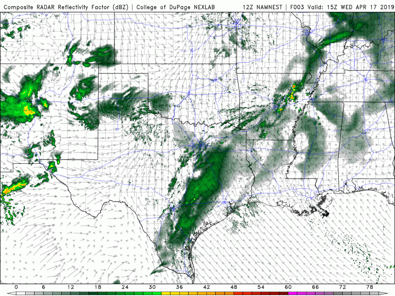
Above are two loops of forecast model generated simulated reflectivity; HRRR on the left and NAM NEST on the right. Both shower similar solutions, basically discrete storms develop both east and west of I-35 in northern Texas between 4-6 PM today. If I were chasing, I would target these storms; as they have the better chance of visible, photogenic tornadoes.
Going forward, more storms develop along the dryline and along the stationary front connecting the primary and secondary lows. The storms in these two areas will form into a couple different squall lines, eventually merging into one long one. It will be getting dark out at about the same time. So, while tornadoes will still be possible with these squall lines, they will be harder to see.
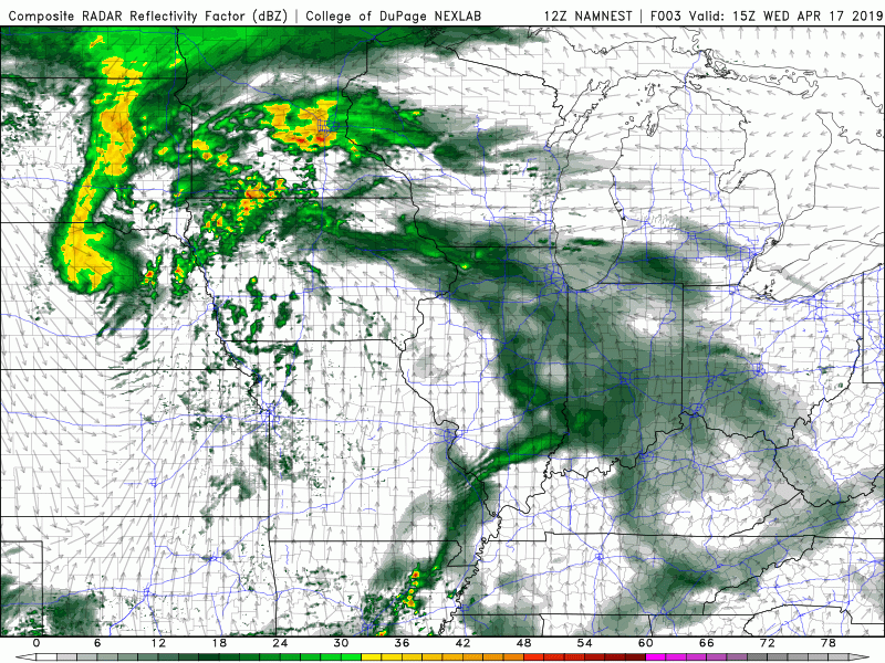
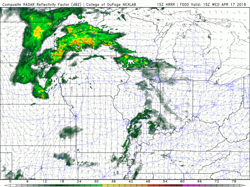
These two simulated reflectivity loops show the storms in the northern target area; again, HRRR on the left, NAM NEST on the right. As you can see, there is already ongoing precipitation to the north, across parts of Iowa, Minnesota, and Wisconsin. The storms of interest will develop along a line stretching from southwestern Wisconsin through eastern Iowa and into northern Missouri.
The storms forecasted (at least by these two forecast models,) to develop along that line are not nearly as impressive as the storms in the south. However, with the amount of wind shear that will be present this afternoon, I still think there will be a decent chance for at least one tornado today. As today goes into tonight, the storms form into a squall line. Again, this squall line could still produce tornadoes.
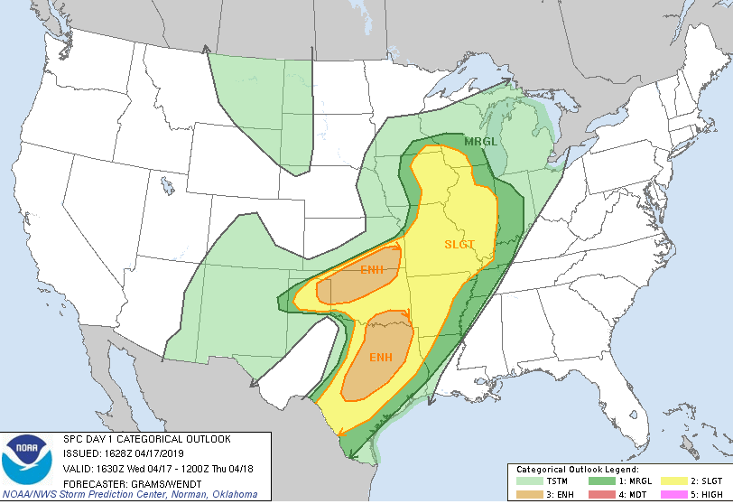
So, to summarize, severe weather is very likely today. The southern area will likely have the most severe weather today, with large hail (possibly baseball sized in some cases,) being the most likely concern. I’m sure there will be at least a couple tornadoes down there as well. Severe weather in the northern target should be more limited. But I think, with the amount of wind shear up there, that there be at least one tornado in eastern Iowa or western Illinois today.
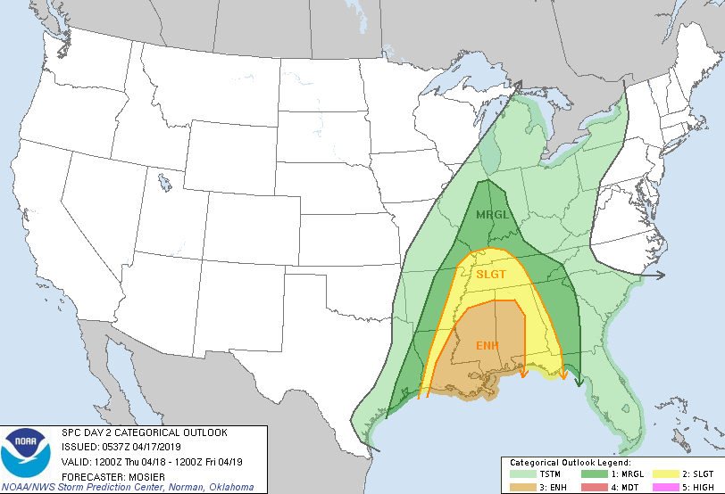
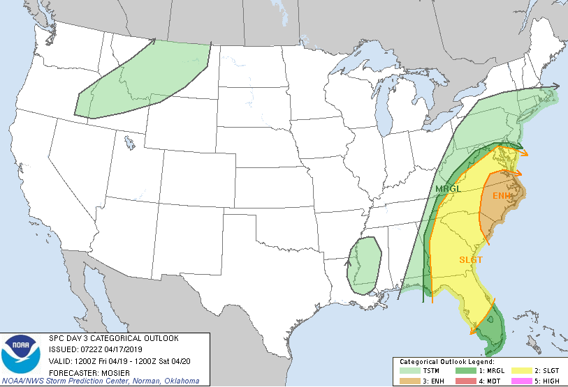
The severe weather event will continue on through Thursday and Friday as well; moving from the Midwest to Dixie Alley, and then to the east coast.