Storm Chasing
Storm Chase of December 23, 2015

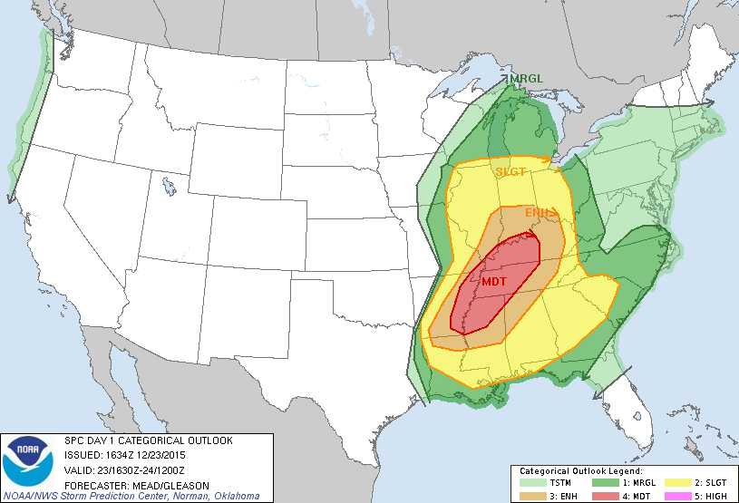
The Storm Prediction Center 1200z Convective Outlook.
December 23rd was another one of those days where I do just about everything right, but mother nature doesn't cooperate. I had been watching this event since about before it happened. I recognized that the areas to the south were more likely to get tornadoes, but there was also a chance for some in western Illinois. The day of the event, I watched the weather intently, doing hand drawn surface plots every hour at work. As soon as I was off work, I jumped in the car and headed west.
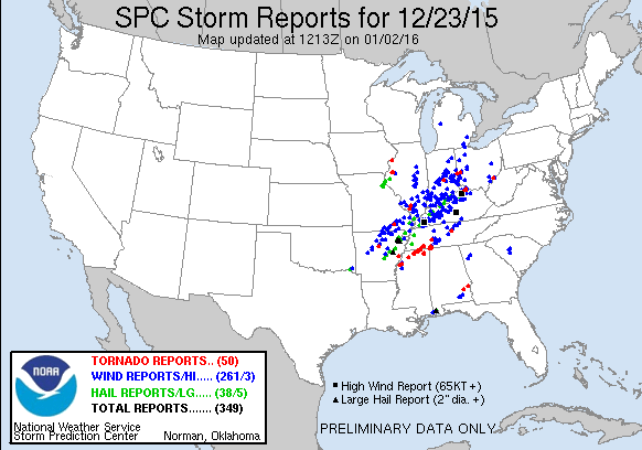
My target area was Mount Sterling. Along the way, I watched storms develop in northeastern Missouri and head my way. I made it to Mount Sterling, and set up shop on the western side of town, in the parking lot of a small airport. I watched the storms approach, and watched two supercells go to my north, and one to my south. The one to my south did get a Tornado Warning at one point, but did not drop anything. A storm further to the north, near Macomb, did drop a tornado.
The storm I was on did develop low level rotation. I did a short time lapse as it passed by me, and then hopped on the road. I was partially chasing after the storm, and partially heading home. I hoped that maybe, just maybe, the storm would drop something briefly, right at sunset. It would have been neat to get a tornado a couple days before Christmas. Alas, nothing happened.
What I did see was a beautiful sunset and some of the most vividly blue sky I have ever seen. I regret not stopping and taking a picture.


