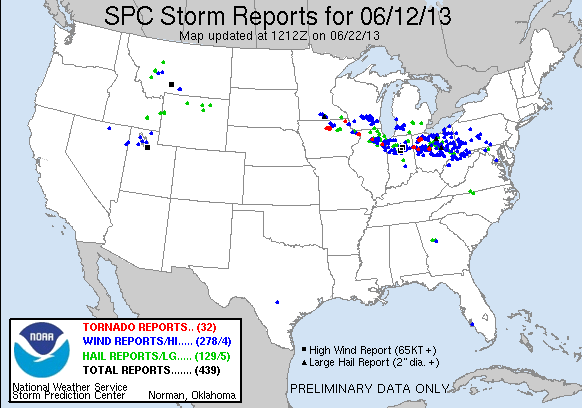


Storm Chasing
Storm Chase of 12 June, 2013
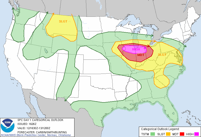
Storm Prediction Center's 1630z Convective Outlook.
This was the first High Risk day of 2013, and my home town was included. Honestly, from the beginning I thought it was being overhyped. People were calling for a big tornado outbreak, and then a derecho. I thought there would be severe storms and maybe a couple tornadoes. But hey, how often does northern Illinois get a High Risk? So I chased.
My initial target was Freeport, in far northwestern Illinois. I got to Freeport as storms were firing. I grabbed some lunch and waited for them to develop, and deciding when to make my move. Some storms moved over me at my position in Freeport, and I decided to hang around for a while and watch them. Meanwhile, there was a storm further south that I had my eye on.
My memory is a little fuzzy, but I believe I either decided to try go east and get ahead of that southern storm, or just head east to stay with the storms. But as I drove east, a storm immediately to my south became tornado warned. I decided to go after it. As I drove south to get a better view, I could hear tornado sirens go off. I eventually got right under the hook of the storm, and managed to video and photo a rotating wall cloud, and possibly a funnel.
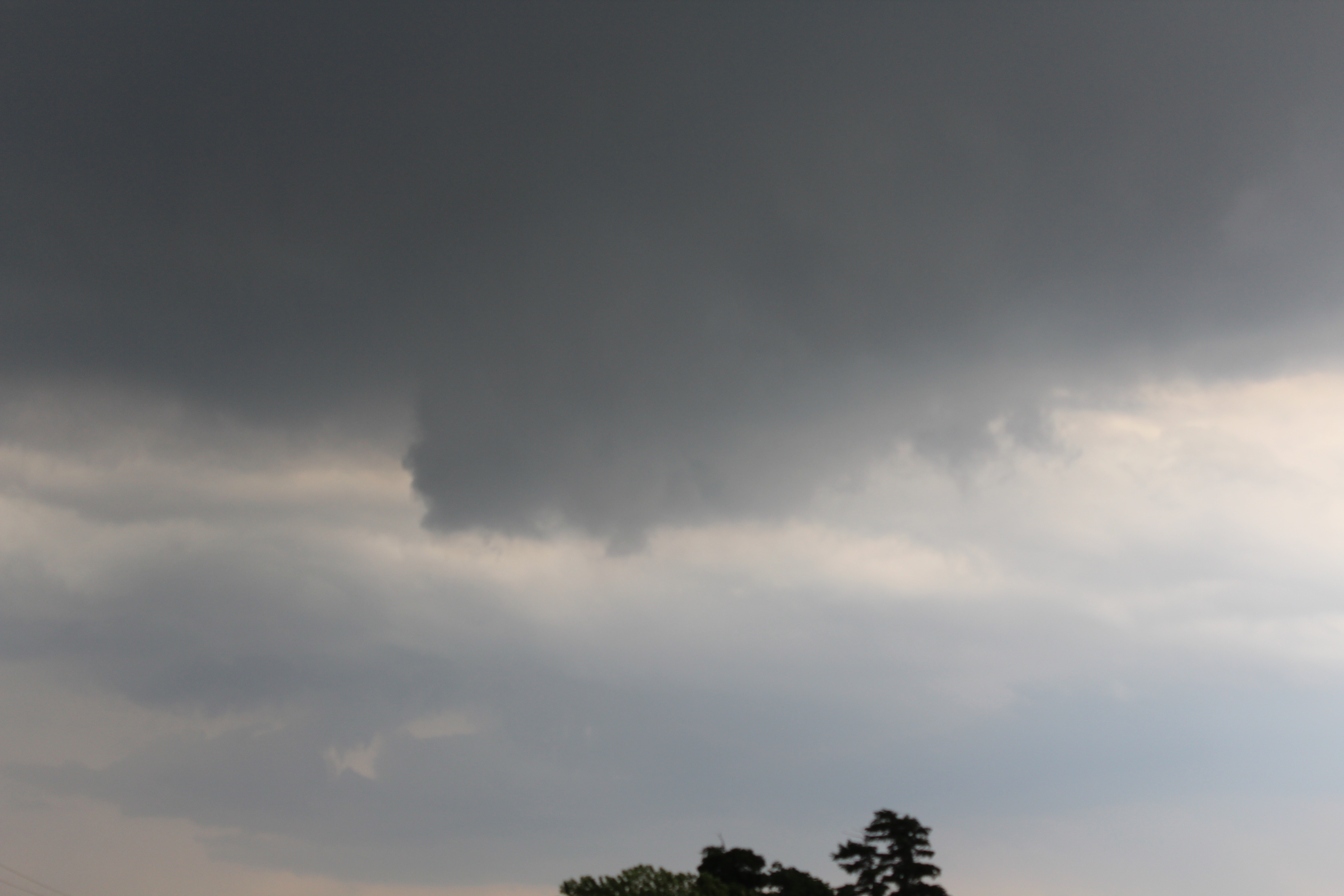 |
The wall cloud ended up not dropping anything. I chased after the storm for a while, but eventually gave up hope as it became more linear and less supercellular. That storm I had been watching further south did end up dropping two tornadoes, one being an EF2, the other a EF0. I called it a day, and headed home.
My "High Risk No-Tornado" trend continues...