


Storm Chasing
Storm Chase of 04 October, 2013
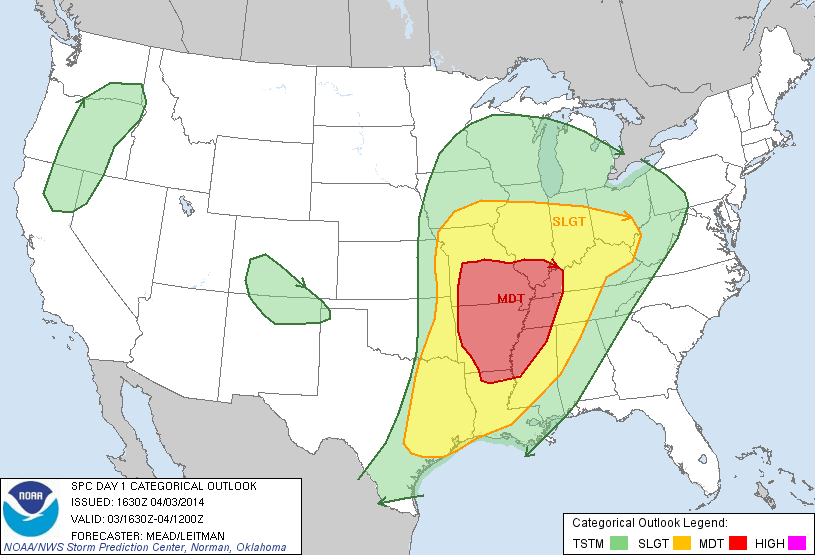
Storm Prediction Center's 1630z Convective Outlook.
First storm chase of the year! I had high hopes for this day in the proceeding days up until this event. But the morning of the event, I was much more pessimistic. For one, I didn't have what I would call a "free range of opportunities." By that, I mean that I couldn't chase where ever I liked. I was actually skipping a class to chase on this day, and I still had class the next day. So the further I drove to storm chase, the further I would have to drive back that night in order to be able to attend class the next day.
With that stipulation in place, I was pretty much limited to central/western Illinois and northern Missouri. Missouri seemed to have a better chance of tornadic activity, but the terrain is very undesirable, and Missouri is still a relatively long drive away. Western Illinois on the other hand was only 3 to 4 hours away. But the forecast models were devided on how the weather would unfold. The GFS was the most favorable, with high CAPE values, good wind shear and helicity. If the GFS had been correct, any storm that ventured into western Illinois would have probably dropped a tornado.
The NAM and the RAP were much less favorable to western Illinois. In the end, the NAM and RAP were correct in the regards that nothing but rain happened in western Illinois. But at the same time, all the forecast models were collectively wrong. The surface low responsible for the severe weather move much slower than expected. The warm front I had placed on hanging near stalled way south of me. The result was western Illinois stayed cloudy, rainy, and chilly most of the day. There was zero instability.
The warm front really didn't start moving north until around 5 PM (22z), which resulted into the Moderate Risk area not really seeing any tornadic activity until after dark. In fact, some of the strongest severe weather occured outside of the Moderate Risk box, in northwestern Texas. Denton, TX in particular got hit pretty hard; first hit by baseball and softball sized hail, and then a tornadic storm moved through. Arkansas, which had originally had been pretty much entirely under the Moderate Risk box, really didn't see all that much severe weather.
My actual storm chase was very uneventful. I hit the road heading for Jacksonville, IL. I got there around 3 PM. I sat in a Walmart's parking lot until about 5 PM, seeing nothing much light to moderate rain. Then I decided to head for home. The weather at home while I was preparing to leave in the morning was actually more interesting than the weather I saw during the chase.

Brian needs to update me tomorrow!